Trail Walking La Chapelle-en-Valgaudémar - Cabane du Près de l'Ours.Rif du Sap.06/09/20. - Photo

Cabane du Près de l'Ours.Rif du Sap.06/09/20.

© OpenStreetMap contributors
Length
Length
5 km
Max alt
Max alt
1764 m
Uphill gradient
Uphill gradient
539 m
Km-Effort
Km-Effort  
12.1 km
Min alt
Min alt
1309 m
Downhill gradient
Downhill gradient
539 m
Boucle
Boucle
Yes
Creation date :
2020-09-06 12:32:57.545
Updated on :
2020-09-06 17:24:03.088

(0 Reviews)

Walking
Walking
1h35
Difficulty : Easy

Scan this QR Code to open this trail in the SityTrail application

FREE GPS app for hiking

Logo SityTrail SityTrail

IGN / Geographical institutes

Download SityTrail from the App Store Download SityTrail from Google Play

Logo SityTrail SityTrail World

The world is yours!

Download SityTrail from the App Store Download SityTrail from Google Play Download SityTrail on Huawei AppGallery

About

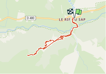
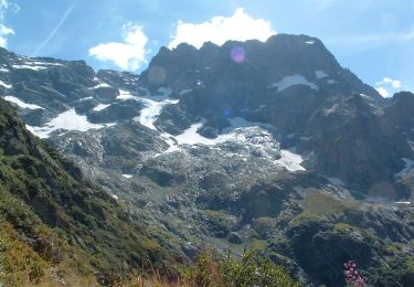
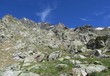
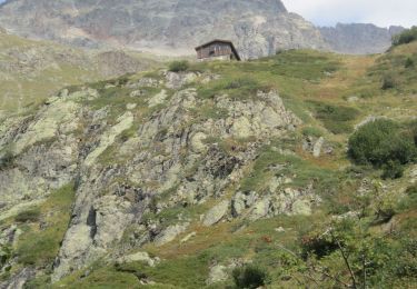
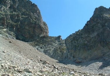
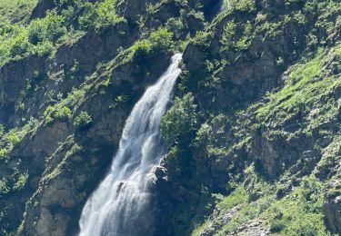
Trail Walking of 5 km to be discovered at Provence-Alpes-Côte d'Azur, Hautes-Alpes, La Chapelle-en-Valgaudémar. This trail is proposed by Dervalmarc.

Description

Vallon très sauvage et méconnu du Parc national des Écrins.
points de vue sur le Vallon supérieur de Chalance.

Elevation profile

Photos

Positioning

Country:
France
Region :
Provence-Alpes-Côte d'Azur
Department/Province :
Hautes-Alpes
Municipality :
La Chapelle-en-Valgaudémar
Location:
Unknown
Start:(UTM)
283503 ; 4967358 (32T) N.

Trails nearby

Trail Walking La Chapelle-en-Valgaudémar - circuit de la cabane de l'aup .08-06-14 - Photo
Walking
Dervalmarc

Walking

Very easy
(1)
La Chapelle-en-Valgaudémar, Provence-Alpes-Côte d'Azur, Hautes-Alpes, France
8.8 km | 13.6 km-effort
2h 37min
Yes
Trail Walking La Chapelle-en-Valgaudémar - Tour du Vieux Chaillol 2/5 - Du Gîte Le Casset au Refuge de Vallonpierre - Photo
Walking
tracegps

Walking

Medium
(1)
La Chapelle-en-Valgaudémar, Provence-Alpes-Côte d'Azur, Hautes-Alpes, France
11.8 km | 24 km-effort
4h 30min
No
Trail Walking La Chapelle-en-Valgaudémar - PARC NATIONAL DES ECRINS: REFUGE DU PIGEONNIER - Photo
Walking
djeepee74

Walking

Medium
La Chapelle-en-Valgaudémar, Provence-Alpes-Côte d'Azur, Hautes-Alpes, France
9.4 km | 21 km-effort
3h 22min
Yes
Trail On foot La Chapelle-en-Valgaudémar - Refuge du Pigeonnier - Photo
On foot
Marco05

On foot

Difficult
La Chapelle-en-Valgaudémar, Provence-Alpes-Côte d'Azur, Hautes-Alpes, France
7.8 km | 18.6 km-effort
4h 13min
Yes
Trail On foot La Chapelle-en-Valgaudémar - Refuge de Vallonpierre - Photo
On foot
Marco05

On foot

Difficult
La Chapelle-en-Valgaudémar, Provence-Alpes-Côte d'Azur, Hautes-Alpes, France
13.8 km | 24 km-effort
5h 33min
Yes
Trail Walking La Chapelle-en-Valgaudémar - Refuge de Chalance - Photo
Walking
Marco05

Walking

Difficult
La Chapelle-en-Valgaudémar, Provence-Alpes-Côte d'Azur, Hautes-Alpes, France
7.5 km | 22 km-effort
5h 1min
Yes
Trail On foot La Chapelle-en-Valgaudémar - Refuge de Chabournéou - Photo
On foot
Marco05

On foot

Medium
La Chapelle-en-Valgaudémar, Provence-Alpes-Côte d'Azur, Hautes-Alpes, France
10.2 km | 17.1 km-effort
3h 53min
Yes
Trail Walking La Chapelle-en-Valgaudémar - Pas de l'Olan - Photo
Walking
Marco05

Walking

Very difficult
La Chapelle-en-Valgaudémar, Provence-Alpes-Côte d'Azur, Hautes-Alpes, France
12.6 km | 34 km-effort
7h 37min
Yes
Trail Walking La Chapelle-en-Valgaudémar - Valgo 2 - J6 : refuge du Pigeonnier - Photo
Walking
ETMU5496

Walking

Difficult
La Chapelle-en-Valgaudémar, Provence-Alpes-Côte d'Azur, Hautes-Alpes, France
13.4 km | 27 km-effort
4h 15min
Yes


Close
My subscriptions